Imagery from Bolivia and Chile - Part 1
I've just returned from one of the most exciting photography trips I've ever taken. For the past two weeks, I have been traveling around Chile and Bolivia with a group of photography enthusiasts - both professional and amateur and from 7 countries - recording the landscapes, wildlife, and culture, all of which proved to be diverse and unique to the areas we visited. This is my first post of three this year on my imagery from Bolivia and Chile.
We met in Santiago, Chile since it was the most central meeting point for air travel, but the photography began in San Pedro de Atacama, a small town in northern Chile.
Decorative plates at a shop in San Pedro de Atacama
From San Pedro de Atacama, we traveled locally to photograph El Valle de la Luna, El Valle de la Muerte, and Chaxa Lake:
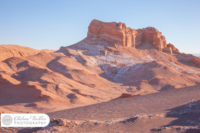
Rock formations and sand dunes at El Valle de la Luna, Chile.
Lincanabur Volcano on the border of Chile and Bolivia, as seen from El Valle de la Luna.
Chaxa Lake at sunrise
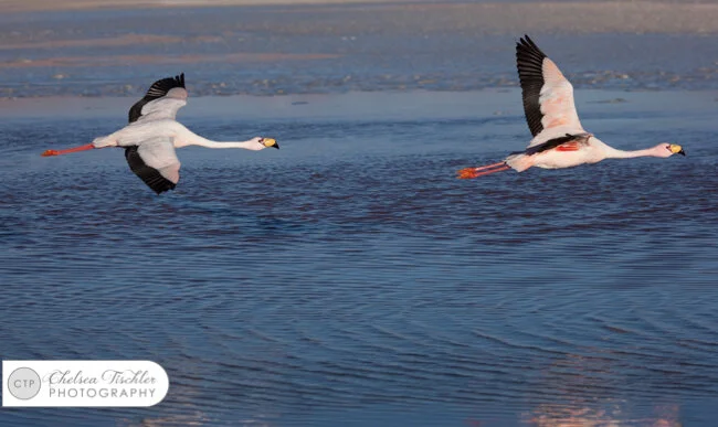
James Flamingo in flight over Laguna de Chaxa
Our next stop was the Tatio Geysers (Chile), at 14,000+ feet. There are over 80 active geysers there, making it the 3rd largest geyser field in the world, and the largest in the southern hemisphere.
Then, we crossed over the border into Bolivia, where the real adventure began. At the border, which was literally a ditch with a small building for customs, we met our drivers and two of their wives who cooked for us, and we set off in 4x4 Land Cruisers. We did not see a tarmac road the entire week we were in Bolivia, and for much of that time, there was no road whatsoever. I loved it.
The Chile-Bolivia border, as seen from the Bolivia side looking into Chile. The building is a Chilean tourism office. (It was closed.)
We set off in our 4x4s, and made our way up to the Siloli desert, while stopping at several scenic areas: Laguna Blanca, Laguna Verde, Geisers Sol de Mañana, and finally Laguna Colorada, all in the first day. The rich mineral deposits in this region of Bolivia give these natural lakes their vibrant colors.
Panorama of Laguna Blanca
Laguna Verde
Volcanic Remnants
Scenic lunch spot at the hot springs
By the time we got to the Geisers del Sol Mañana (16,400 ft), I was feeling the effects of the altitude, and when I exited the vehicle, the smell of sulphur just exacerbated the altitude sickness. The geysers were really interesting, but my photography from that part of day 1 was extremely minimal.
When we arrived at Laguna Colorada, I was still feeling weak from the high altitude and it was physically challenging to carry my equipment up and down the steep hill. (The panoramic photo below does not do justice to the grade of the path.) There was plenty of light, so I opted to hand-hold for the afternoon; thankfully by the time I got to the bottom the hill, I started to feel better.
Panorama of Laguna Colorada
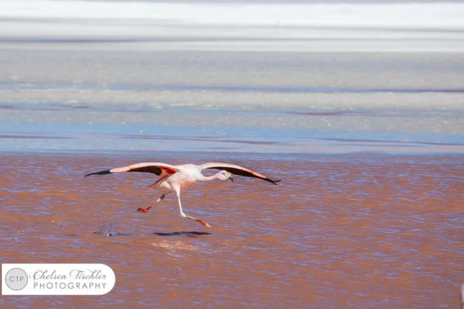
James Flamingo walking in Laguna Colorada
Laguna Colorada
We then made our way to our desert lodge, where we stayed for two nights. It was charming in a rustic, adventurous way; it was literally in the middle of nowhere in the Siloli desert. Electricity was created on-site via a generator, which ran only a few hours per day to conserve fuel. Since it had not occurred to me ahead of time that there might be limited electricity on the trip, I had not packed multiple extra batteries or charging adaptors. So my first priority was to make sure my batteries were charging when the generator was on, and once they were finished I had to plug in my computer to download my images from my memory cards.
Because of its location (high altitude, middle of nowhere in the driest place on Earth), the conditions were perfect for star photography. So, for the two nights we stayed there, I woke up early to capture the Milky Way after the moon set but before the sun rose.
Milky Way, as seen from our desert hotel
We then set off to photograph some rock formations at sunrise, including a rock that was shaped like a tree. Then back to Laguna Colorada for sunset, where it was all about the Flamingoes.
The next day, we began the two-day drive to the salt flats. Here's what our journey looked like:
Desert “road”
Canyon “road”
Below is our AMAZING crew of drivers from Tupiza, who put in some very, very long hours on challenging terrain to get us to where we wanted to go. As a side note, I have traveled a lot - to about 30 countries on all 7 continents - and the service experience I had with these guys was the best I have encountered anywhere in the world. I could go on forever about how great the service was, but you could just read my effusive TripAdvisor review.
Our drivers
Photo from the drive.
We made a lot of stops that day. The next two photos are from Laguna Hedionda and Laguna Cañapa, although I am not 100% sure. After that, we stopped briefly to photograph the railroad tracks before continuing on to see the Valle de Rocas. Our final stop of the day was to photograph the bright yellow quinoa fields off the side of the road, before arriving at our hotel in San Juan.
Panorama of Laguna Hedionda, which literally translates to "Hideous Lake". It was very stinky
Flamingoes on Laguna Cañapa
Never-ending train tracks
Yellow Quinoa Fields
Valle de Rocas, created by a volcanic explosion. The rocks were projected into the ground at an angle due to the force of the volcano’s eruptions, and they have lay dormant for thousands of years with little erosion because of the arid climate.
That's all I've got for now. Stay tuned for Part 2 of the trip, which includes photos from the 3 days I spent at the Salar de Uyuni, and our last few days in Chile before heading back to the States.


